
Parks & Nature
Parks & Nature
Outdoor recreation and activities in Utah are endless. Here are few quick and close goodies to try out!
Liberty Park is a popular public urban park in Salt Lake City, Utah. It is the city's second-largest public park, at 80 acres, being surpassed only by Sugarhouse Park which has 110.5 acres. The park features a pond with two islands, and is also the location of Tracy Aviary.
19 moradores locais recomendam
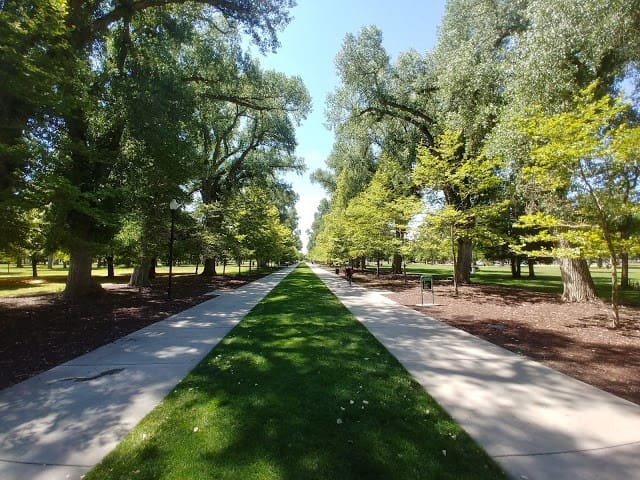
Liberty Park
600 Harvey Milk BoulevardLiberty Park is a popular public urban park in Salt Lake City, Utah. It is the city's second-largest public park, at 80 acres, being surpassed only by Sugarhouse Park which has 110.5 acres. The park features a pond with two islands, and is also the location of Tracy Aviary.
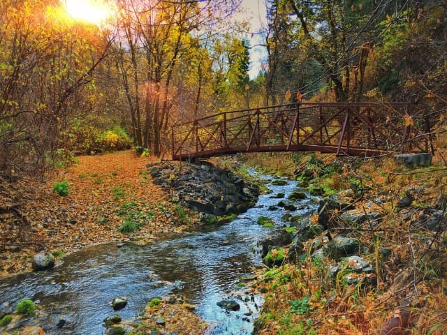
The Living Room Trail is a short, fairly steep, but moderately easy hike to a great viewpoint on Red Butte overlooking the Salt Lake Valley. At the viewpoint, you'll see "furniture" created by other hikers out of the large flat sandstone slabs. There are several "chairs" and "couches" complete with armrests and ottomans. The rock furniture is a surprisingly comfortable place to relax while you take in the view—a total view from the very north end to the very south end of the Salt Lake Valley.
28 moradores locais recomendam
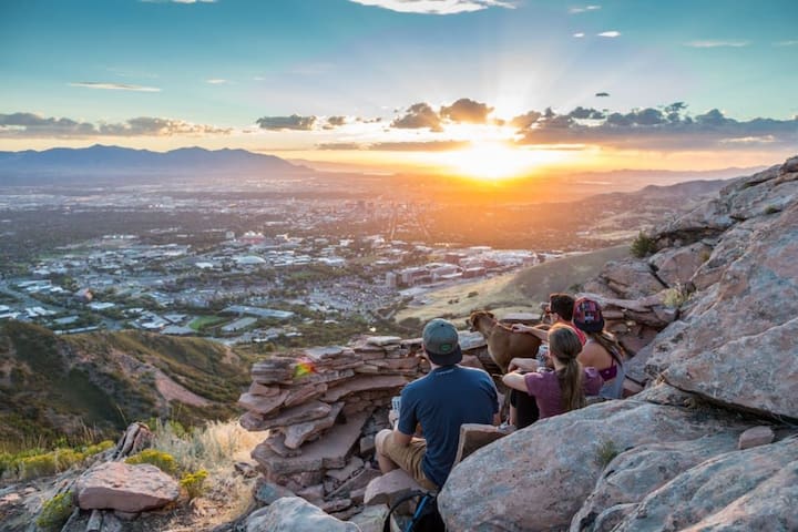
Living Room Trail
Living Room TrailThe Living Room Trail is a short, fairly steep, but moderately easy hike to a great viewpoint on Red Butte overlooking the Salt Lake Valley. At the viewpoint, you'll see "furniture" created by other hikers out of the large flat sandstone slabs. There are several "chairs" and "couches" complete with armrests and ottomans. The rock furniture is a surprisingly comfortable place to relax while you take in the view—a total view from the very north end to the very south end of the Salt Lake Valley.
This little peak is the perfect way to view the city. Just don't do it on the hottest day of the year because you'll hate it. Take a picnic and watch the sunset. Ensign Peak is at the north end of the Salt Lake Valley, above the State Capitol building.
Two days after arriving in the Salt Lake Valley, Brigham Young and seven other pioneer leaders climbed the mountain to survey the valley. From its summit they laid out in their minds the city they intended to build. A small monument now sits on the summit.
27 moradores locais recomendam
Ensign Peak Trailhead
Ensign Peak TrailThis little peak is the perfect way to view the city. Just don't do it on the hottest day of the year because you'll hate it. Take a picnic and watch the sunset. Ensign Peak is at the north end of the Salt Lake Valley, above the State Capitol building.
Two days after arriving in the Salt Lake Valley, Brigham Young and seven other pioneer leaders climbed the mountain to survey the valley. From its summit they laid out in their minds the city they intended to build. A small monument now sits on the summit.
Since the park’s formation in the 1950's, Sugar House Park has been the crown jewel of the historic Sugar House area of Salt Lake City. The 110 acre park features several amenities as well as a large pond, hilly areas ideal for sledding, access to Parley's Trail, and a 1.38 mile road with a 16 foot inside lane for pedestrians.
197 moradores locais recomendam
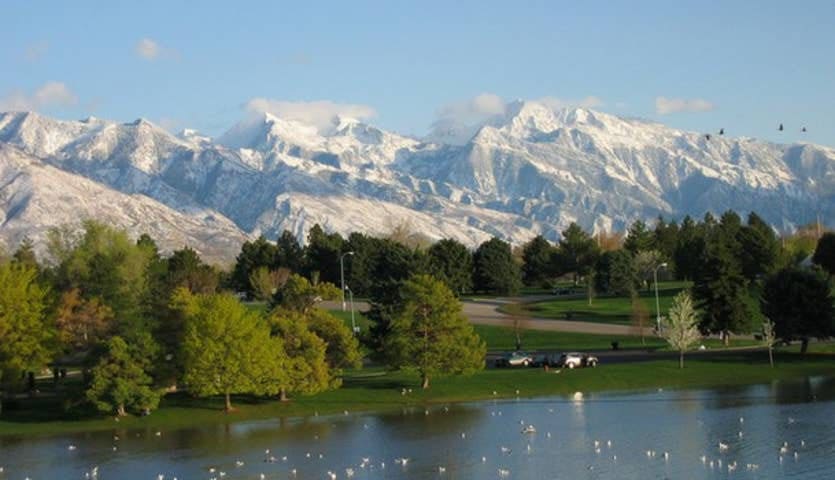
Sugar House Park
1330 2100 SSince the park’s formation in the 1950's, Sugar House Park has been the crown jewel of the historic Sugar House area of Salt Lake City. The 110 acre park features several amenities as well as a large pond, hilly areas ideal for sledding, access to Parley's Trail, and a 1.38 mile road with a 16 foot inside lane for pedestrians.
This park features memorials to Utah’s veterans and a replica of the Liberty Bell. City Creek Canyon road is a walking, jogging, and bicycling route extending into the mountains to the northeast.
152 moradores locais recomendam
Memory Grove Park
300 N Canyon RdThis park features memorials to Utah’s veterans and a replica of the Liberty Bell. City Creek Canyon road is a walking, jogging, and bicycling route extending into the mountains to the northeast.
Exploring City Creek via Canyon Road or the adjacent wooded trail is super crazy accessible from downtown on foot. Start at the intersection of North Temple and State Street. If you head east on North Temple, you'll be on 2nd Avenue. Hang a left (north) onto Canyon Road towards Memory Grove. If you've got a car, you can park on Canyon Road before the entrance of Memory Grove.
Hiking City Creek Road
City Creek road is paved and great for walking, running, and biking. The first 3.6 miles run alongside a beautiful mountain stream, and the final 2 miles take explorers to Rotary Park.
City Creek Hiking Trail
There is a wooded trail that runs adjacent to the road and is 3 miles up to the water-treatment plant. The beginning of the trail is shared with the Bonneville Shoreline Trail, and you can choose to stay along the City Creek Trail or veer off up into the hills on the Bonneville Shoreline Trail.
70 moradores locais recomendam
City Creek Canyon
City Creek Canyon RoadExploring City Creek via Canyon Road or the adjacent wooded trail is super crazy accessible from downtown on foot. Start at the intersection of North Temple and State Street. If you head east on North Temple, you'll be on 2nd Avenue. Hang a left (north) onto Canyon Road towards Memory Grove. If you've got a car, you can park on Canyon Road before the entrance of Memory Grove.
Hiking City Creek Road
City Creek road is paved and great for walking, running, and biking. The first 3.6 miles run alongside a beautiful mountain stream, and the final 2 miles take explorers to Rotary Park.
City Creek Hiking Trail
There is a wooded trail that runs adjacent to the road and is 3 miles up to the water-treatment plant. The beginning of the trail is shared with the Bonneville Shoreline Trail, and you can choose to stay along the City Creek Trail or veer off up into the hills on the Bonneville Shoreline Trail.
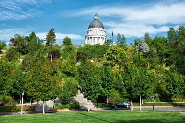
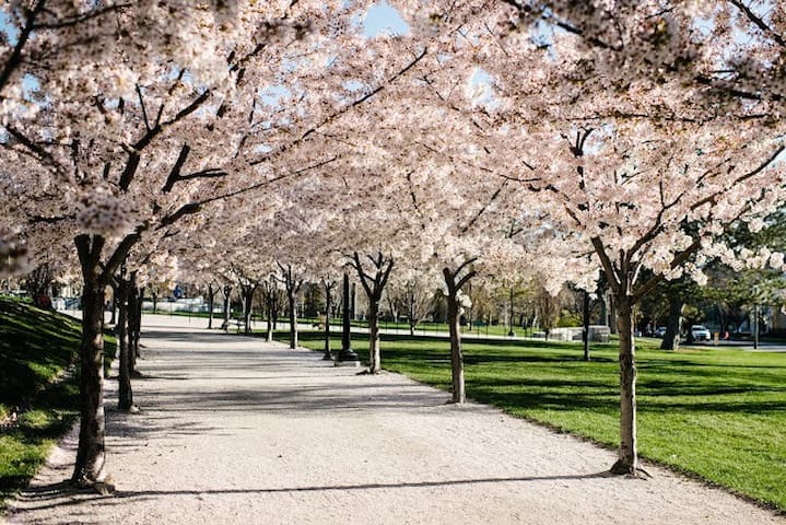
The 2004–2008 Capitol restoration project dramatically changed the grounds once again. Today, the grounds more closely honor Richard K.A. Kletting’s original plans for the area, and Capitol Hill includes six buildings; sprawling lawns; a central plaza with a reflecting pond; a .7 mile circular walkway boasting 433 yoshino cherry trees; and a broad collection of monuments, plaques, and statuary.
34 moradores locais recomendam
Capitol Hill
The 2004–2008 Capitol restoration project dramatically changed the grounds once again. Today, the grounds more closely honor Richard K.A. Kletting’s original plans for the area, and Capitol Hill includes six buildings; sprawling lawns; a central plaza with a reflecting pond; a .7 mile circular walkway boasting 433 yoshino cherry trees; and a broad collection of monuments, plaques, and statuary.