
Michael's Guidebook
Neighbourhoods
Kippford is a holiday village and popular for sailing. Positioned along the banks of the River Urr. The waterfront is lined with pretty, whitewashed cottages and, from here, you can walk along the shore road to the beaches. Kippford is home to the Solway Yacht Club who hold a sailing regatta here annually. Beyond Kippford is the “Muckle”, a forest with a network of paths that lead you to Rockcliffe. The village also has two pubs serving local ale and food, a chandlery and slipway, a village hall, a gift shop which also sells coffee, cake and ice cream, a family run craft pottery and a family friendly nine-hole golf course and tea room.
30 moradores locais recomendam
Kippford
Kippford is a holiday village and popular for sailing. Positioned along the banks of the River Urr. The waterfront is lined with pretty, whitewashed cottages and, from here, you can walk along the shore road to the beaches. Kippford is home to the Solway Yacht Club who hold a sailing regatta here annually. Beyond Kippford is the “Muckle”, a forest with a network of paths that lead you to Rockcliffe. The village also has two pubs serving local ale and food, a chandlery and slipway, a village hall, a gift shop which also sells coffee, cake and ice cream, a family run craft pottery and a family friendly nine-hole golf course and tea room.
Rockcliffe is one of a number of small seaside villages along the stretch of the north shore of the Solway Firth known as the Colvend Coast. To reach it you turn off the A710 in Colvend, five miles south of Dalbeattie, and travel just over a mile (passing Torbay en route!) to the southern end of Rockcliffe itself.
The road ends in Rockcliffe, and although there are a few parking places at the north west end of the village, your best bet is to park in the signed parking area just above its south east end, i.e. before you actually get into the village itself.
Rockcliffe is an extremely pretty place. An arc of largely white-painted houses and cottages stand on the landward side of the road, looking out over the beach. The village stands on the east side of the mouth of Rough Firth, the estuary of the Urr Water.
Two islands are visible offshore. The more distant is Hestan Island, complete with its lighthouse and cottages. Closer in, a third of a mile from Rockcliffe, is Rough Island. This is accessible on foot at low tide, either via a causeway of sorts from the north, or directly across the sand from Rockcliffe. Anyone intending to visit should first find out how long they have before the incoming tide cuts the island off once more: and the island should be avoided in May and June to allow nesting seabirds to breed in peace.
The beach at Rockcliffe attracts many visitors, though it has two very different aspects, depending on the state of the tide. Visit at high tide and the sea can be within a few yards of the sloping wall beside the road. At low tide, on the other hand, the nearest open water can be the better part of a mile away, beyond the beaches and the craggy rocks that punctuate them, beyond Rough Island, and beyond the mudflats in the estuary.
There is very little commercial activity in Rockcliffe. Outside the village itself, much of the land in the area is owned by the National Trust for Scotland (NTS). This includes parts of the coastal strip south to Castlehill Point, which marks the true entrance to Rough Firth, and Rough Island.
The NTS also owns much of the coastal land north west of Rockcliffe, through which a footpath, the Jubilee Path, leads to Kippford, a mile away. A beautiful and manageable coastal walk, en route you pass the Mote of Mark. This dark age hillfort overlooks the Urr Estuary and is thought to have been occupied for up to 300 years until being destroyed by fire in the 700s. It is said to be named after Mark, King of Dumnonia, and links have been made with the story of Tristan and Isolde and with the legends of King Arthur.
19 moradores locais recomendam
Rockcliffe
Rockcliffe is one of a number of small seaside villages along the stretch of the north shore of the Solway Firth known as the Colvend Coast. To reach it you turn off the A710 in Colvend, five miles south of Dalbeattie, and travel just over a mile (passing Torbay en route!) to the southern end of Rockcliffe itself.
The road ends in Rockcliffe, and although there are a few parking places at the north west end of the village, your best bet is to park in the signed parking area just above its south east end, i.e. before you actually get into the village itself.
Rockcliffe is an extremely pretty place. An arc of largely white-painted houses and cottages stand on the landward side of the road, looking out over the beach. The village stands on the east side of the mouth of Rough Firth, the estuary of the Urr Water.
Two islands are visible offshore. The more distant is Hestan Island, complete with its lighthouse and cottages. Closer in, a third of a mile from Rockcliffe, is Rough Island. This is accessible on foot at low tide, either via a causeway of sorts from the north, or directly across the sand from Rockcliffe. Anyone intending to visit should first find out how long they have before the incoming tide cuts the island off once more: and the island should be avoided in May and June to allow nesting seabirds to breed in peace.
The beach at Rockcliffe attracts many visitors, though it has two very different aspects, depending on the state of the tide. Visit at high tide and the sea can be within a few yards of the sloping wall beside the road. At low tide, on the other hand, the nearest open water can be the better part of a mile away, beyond the beaches and the craggy rocks that punctuate them, beyond Rough Island, and beyond the mudflats in the estuary.
There is very little commercial activity in Rockcliffe. Outside the village itself, much of the land in the area is owned by the National Trust for Scotland (NTS). This includes parts of the coastal strip south to Castlehill Point, which marks the true entrance to Rough Firth, and Rough Island.
The NTS also owns much of the coastal land north west of Rockcliffe, through which a footpath, the Jubilee Path, leads to Kippford, a mile away. A beautiful and manageable coastal walk, en route you pass the Mote of Mark. This dark age hillfort overlooks the Urr Estuary and is thought to have been occupied for up to 300 years until being destroyed by fire in the 700s. It is said to be named after Mark, King of Dumnonia, and links have been made with the story of Tristan and Isolde and with the legends of King Arthur.
Dalbeattie has much to offer by way of interesting and diverse opportunities……the beautiful rural and coastal scenery…… activities such as the now famous Seven Stanes mountain bike trail in Dalbeattie Forest (one of the most challenging courses of its kind)…forest walks or riding along the many miles of track within Dalbeattie Forest itself or in Barrhill Woods or Rounall Woods.
The museum is a delight telling the heritage of the granite town and her links with the Titanic. Take to the woods and enjoy one of the iconic 7Stanes mountain bike trails; for adrenaline junkies of all ages and abilities.
Granite exported from Dalbeattie went into the Mersey Docks in Liverpool, the Thames Embankment in London, various British lighthouses, even as far as the lighthouse at the southern tip of Ceylon (Sri Lanka). Its most famous use was probably the Eddystone Lighthouse in southern England. The skill of polishing granite to a shinny surface was first developed in Dalbeattie.
Then there are golfing and fishing, historical sites such as the Moyle and Old Buittle Tower, and of course Dalbeattie Museum. And Dalbeattie doesn’t lack art or culture either. There’s the Birchvale Theatre and the Dalbeattie Art Group to name but two.
Even in this small town, there are three award winning butchers.
8 moradores locais recomendam
Dalbeattie
Dalbeattie has much to offer by way of interesting and diverse opportunities……the beautiful rural and coastal scenery…… activities such as the now famous Seven Stanes mountain bike trail in Dalbeattie Forest (one of the most challenging courses of its kind)…forest walks or riding along the many miles of track within Dalbeattie Forest itself or in Barrhill Woods or Rounall Woods.
The museum is a delight telling the heritage of the granite town and her links with the Titanic. Take to the woods and enjoy one of the iconic 7Stanes mountain bike trails; for adrenaline junkies of all ages and abilities.
Granite exported from Dalbeattie went into the Mersey Docks in Liverpool, the Thames Embankment in London, various British lighthouses, even as far as the lighthouse at the southern tip of Ceylon (Sri Lanka). Its most famous use was probably the Eddystone Lighthouse in southern England. The skill of polishing granite to a shinny surface was first developed in Dalbeattie.
Then there are golfing and fishing, historical sites such as the Moyle and Old Buittle Tower, and of course Dalbeattie Museum. And Dalbeattie doesn’t lack art or culture either. There’s the Birchvale Theatre and the Dalbeattie Art Group to name but two.
Even in this small town, there are three award winning butchers.
Castle Douglas – Dumfries & Galloway's Food Town!
Enjoy retail therapy in the hustle and bustle of this market town’s great independent shops, purchase locally-produced food and relax at Threave Gardens where the National Trust’s gardeners are trained.
Castle Douglas is a small town situated between Dumfries and Kirkcudbright. With Loch Ken to the north it makes an ideal centre for exploring Dumfries and Galloway. Threave Castle, the stronghold of the Black Douglases lies very close to Threave Gardens which is well worth visiting. Castle Douglas has been launched as a Food Town and visitors can enjoy a variety of foods in Castle Douglas, whether Eating Out or merely buying quality food products.
Parking a car is easy and free either on the High Street or preferably in the large car park at the top of the town. The town is easily explored by walking down one side of the street and back up the other side. Castle Douglas is well known for its independent shops. Many stores and cafés sell local produce of a high quality and it is easy to see why the town has become known as “The Food Town” of Dumfries and Galloway. Clothes retailers and quality shoe shops attract many shoppers. All in all Castle Douglas is well used by local people looking for quality produce at a reasonable price.
Sulwath Brewery is a small independent brewer located on the High Street and is well worth a visit.
Beside Castle Douglas is Carlingwark Loch, dotted with islands and great for bird watching, boating, learning to sail and picnicking. There is a caravan park and kids’ playground by the loch and at the far end of the loch is National Trust for Scotland’s Threave Garden, House and Estate open to visitors all year.
34 moradores locais recomendam
Castle Douglas
Castle Douglas – Dumfries & Galloway's Food Town!
Enjoy retail therapy in the hustle and bustle of this market town’s great independent shops, purchase locally-produced food and relax at Threave Gardens where the National Trust’s gardeners are trained.
Castle Douglas is a small town situated between Dumfries and Kirkcudbright. With Loch Ken to the north it makes an ideal centre for exploring Dumfries and Galloway. Threave Castle, the stronghold of the Black Douglases lies very close to Threave Gardens which is well worth visiting. Castle Douglas has been launched as a Food Town and visitors can enjoy a variety of foods in Castle Douglas, whether Eating Out or merely buying quality food products.
Parking a car is easy and free either on the High Street or preferably in the large car park at the top of the town. The town is easily explored by walking down one side of the street and back up the other side. Castle Douglas is well known for its independent shops. Many stores and cafés sell local produce of a high quality and it is easy to see why the town has become known as “The Food Town” of Dumfries and Galloway. Clothes retailers and quality shoe shops attract many shoppers. All in all Castle Douglas is well used by local people looking for quality produce at a reasonable price.
Sulwath Brewery is a small independent brewer located on the High Street and is well worth a visit.
Beside Castle Douglas is Carlingwark Loch, dotted with islands and great for bird watching, boating, learning to sail and picnicking. There is a caravan park and kids’ playground by the loch and at the far end of the loch is National Trust for Scotland’s Threave Garden, House and Estate open to visitors all year.
Food Scene
You'll have to drive to this fantastic pub/restaurant, and book beforehand, but you won't be disappointed ... excellent quality food!
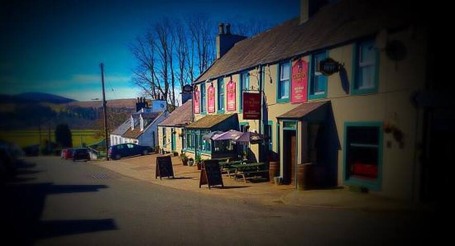
Clachan Inn
8-10 Main StreetYou'll have to drive to this fantastic pub/restaurant, and book beforehand, but you won't be disappointed ... excellent quality food!
Sightseeing
The village of Auchencairn stands on the A711 coast road from Dalbeattie to Kirkcudbright. Close to the northern end of the village a junction beside the war memorial gives access to a minor road that first follows the line of the Hass Burn before turning south east to follow the shore of Auchencairn Bay and Balcary Bay. The road is a little over two miles long, and forms a cul de sac, but if you have the time is well worth exploring.
Auchencairn Bay is one of many bays that indent the north side of the Solway Firth. Some are larger than others and Auchencairn Bay and neighbouring Orchardton Bay are between them relatively modest in scale, being only some two miles long. Their mouth is jointly defined by Almorness Point to the north east and Balcary Point to the south west. Immediately behind Balcary Point is a secondary bay known as Balcary Bay.
The mouth of Auchencairn Bay is given further definition by Hestan Island. Because the bay is broad and shallow, the island is accessible on foot at low tide from Almorness Point via the Hestan Rack, a tidal causeway of shingle and shells. Hestan Island is uninhabited today, but has not always been so. The island has been home to a lighthouse since 1850, and until it was replaced by an automated light, a lighthousekeeper lived on the island in a cottage which still stands. In the 1200s the island was owned by Dundrennan Abbey and used for trapping fish. In the 1342 Edward Balliol, briefly (and arguably) King of Scotland built a manor house here. Its ruins are still visible at the north end of the island.
For an island measuring just 450 metres by 250 metres Hestan Island offers no shortage of interest including caves believed to have been used by smugglers at various times, and the remains of copper mines dug in the 1840s.
The road that runs along the shore of the bay from Auchencairn passes lines of stakes once used for catching fish. It also skirts the estate of Auchencairn House. A screen of woodland means that this is not visible from the road, though its fairytale gatehouse is. The house itself was built in about 1860 for Ivie Mackie, the Lord Mayor of Manchester. It comprises two main ranges and from its raised location offers commanding views over Auchencairn Bay and Hestan Island.
At the head of Balcary Bay stands the very attractive and strikingly white Balcary Bay Country House Hotel. It would be difficult to imagine a more beguiling location for a quiet getaway. The road concludes in a parking area a little beyond the hotel, and from here you can explore the coastline around Balcary Point. In the shelter of the point itself is Balcary Tower.
Balcary bay
The village of Auchencairn stands on the A711 coast road from Dalbeattie to Kirkcudbright. Close to the northern end of the village a junction beside the war memorial gives access to a minor road that first follows the line of the Hass Burn before turning south east to follow the shore of Auchencairn Bay and Balcary Bay. The road is a little over two miles long, and forms a cul de sac, but if you have the time is well worth exploring.
Auchencairn Bay is one of many bays that indent the north side of the Solway Firth. Some are larger than others and Auchencairn Bay and neighbouring Orchardton Bay are between them relatively modest in scale, being only some two miles long. Their mouth is jointly defined by Almorness Point to the north east and Balcary Point to the south west. Immediately behind Balcary Point is a secondary bay known as Balcary Bay.
The mouth of Auchencairn Bay is given further definition by Hestan Island. Because the bay is broad and shallow, the island is accessible on foot at low tide from Almorness Point via the Hestan Rack, a tidal causeway of shingle and shells. Hestan Island is uninhabited today, but has not always been so. The island has been home to a lighthouse since 1850, and until it was replaced by an automated light, a lighthousekeeper lived on the island in a cottage which still stands. In the 1200s the island was owned by Dundrennan Abbey and used for trapping fish. In the 1342 Edward Balliol, briefly (and arguably) King of Scotland built a manor house here. Its ruins are still visible at the north end of the island.
For an island measuring just 450 metres by 250 metres Hestan Island offers no shortage of interest including caves believed to have been used by smugglers at various times, and the remains of copper mines dug in the 1840s.
The road that runs along the shore of the bay from Auchencairn passes lines of stakes once used for catching fish. It also skirts the estate of Auchencairn House. A screen of woodland means that this is not visible from the road, though its fairytale gatehouse is. The house itself was built in about 1860 for Ivie Mackie, the Lord Mayor of Manchester. It comprises two main ranges and from its raised location offers commanding views over Auchencairn Bay and Hestan Island.
At the head of Balcary Bay stands the very attractive and strikingly white Balcary Bay Country House Hotel. It would be difficult to imagine a more beguiling location for a quiet getaway. The road concludes in a parking area a little beyond the hotel, and from here you can explore the coastline around Balcary Point. In the shelter of the point itself is Balcary Tower.
Neighbourhoods
Kirkcudbright – Artists' Town.
The light and colours of this historic harbour town make it a haven for artists and tourists alike. A vibrant summer programme of entertainment culminates in the Floodlit Tattoo, complete with massed pipe bands.
Established as a Royal Burgh in 1455, Kirkcudbright has always been supported by a busy fishing trade. Behind the harbour the streets have housed generations of creative artists, a tradition maintained today by a flourishing colony of painters and craftworkers.
This has led to it being called “The Artists’ Town” Other well known features of the town are the pastel coloured houses and wide streets. We have a wide selection of mainly family owned shops where almost everything can be got, and parking is free all over town.
Although Kirkudbright itself is on the estuary of the River Dee, there is an excellent beach – Dhoon Beach a mile or two along the coast. The beach is great for bathing and has views of the lighthouse on Ross Island.
Each year, a wide range of events are held including the Kirkcudbright Jazz Festival and The Kirkcudbright Art & Crafts Trail.
51 moradores locais recomendam
Kirkcudbright
Kirkcudbright – Artists' Town.
The light and colours of this historic harbour town make it a haven for artists and tourists alike. A vibrant summer programme of entertainment culminates in the Floodlit Tattoo, complete with massed pipe bands.
Established as a Royal Burgh in 1455, Kirkcudbright has always been supported by a busy fishing trade. Behind the harbour the streets have housed generations of creative artists, a tradition maintained today by a flourishing colony of painters and craftworkers.
This has led to it being called “The Artists’ Town” Other well known features of the town are the pastel coloured houses and wide streets. We have a wide selection of mainly family owned shops where almost everything can be got, and parking is free all over town.
Although Kirkudbright itself is on the estuary of the River Dee, there is an excellent beach – Dhoon Beach a mile or two along the coast. The beach is great for bathing and has views of the lighthouse on Ross Island.
Each year, a wide range of events are held including the Kirkcudbright Jazz Festival and The Kirkcudbright Art & Crafts Trail.